Maps
Cartographic Heritage of Lebanon & Phoenicia
From ancient Phoenician trade routes to modern topographic reliefs of Lebanon's dramatic landscape — our map collection spans millennia of cartographic artistry. Each map is a window into a land shaped by history, culture, and the sea.
Maps Collection
7 pieces available
Lebanon Topographic Map
Detailed topographic map of Lebanon with elevation contours, major cities, rivers, and mountain ranges. Printed on premium archival paper.
Ancient Phoenicia Map
Historical map depicting the Phoenician city-states and trade routes across the Mediterranean, circa 1200–800 BCE. A stunning piece of historical cartography.
3D Relief Map of Lebanon
Stunning three-dimensional relief map showcasing Lebanon's dramatic landscape — from the Mediterranean coast to the Mount Lebanon range and the Bekaa Valley.
Beirut City Map — Art Print
Artistic rendering of Beirut's city streets and neighborhoods. A beautiful wall piece for any home or office.
Lebanon Districts Map
Comprehensive administrative map showing all Lebanese districts (mohafazat) with borders, capitals, and key geographical features.
Phoenician Trade Routes Map
Illustrated map of the ancient Phoenician maritime trade network spanning the Mediterranean, from Tyre and Sidon to Carthage and beyond.
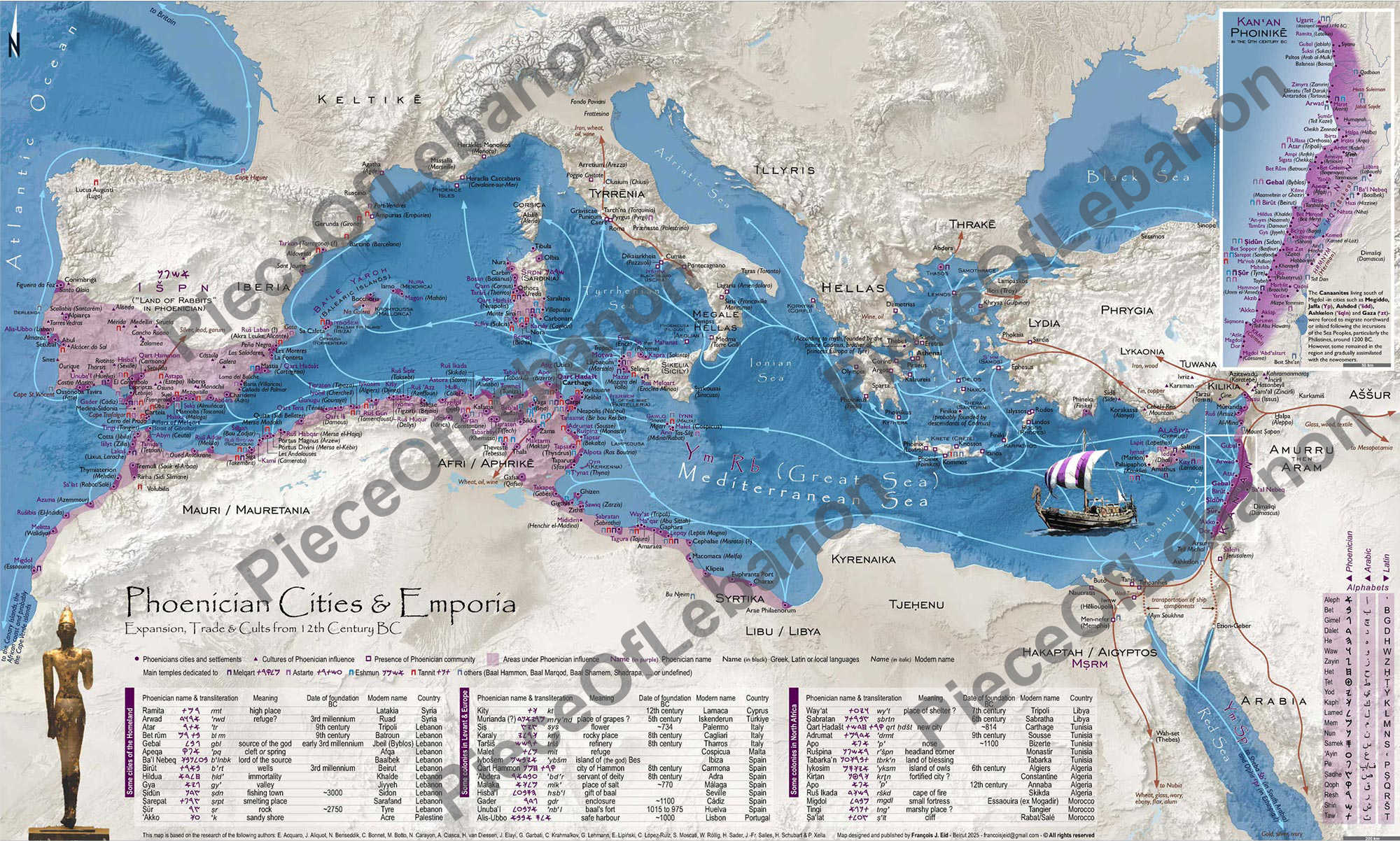
Phoenician Cities and Emporia Map
Comprehensive historical map showing Phoenician cities, settlements, and trade emporia across the Mediterranean and beyond. Expansion, trade, and cultural influence from the 12th century BCE onwards. A detailed cartographic representation of one of history's greatest civilizations.